
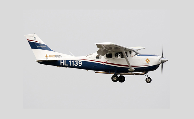
– Size : 2.83 m * 8.61m * 10.97m
– Weight : 1,042kg
– Design Operating Speed : 149kts/275km
– Cruising Speed : 164kts/303km
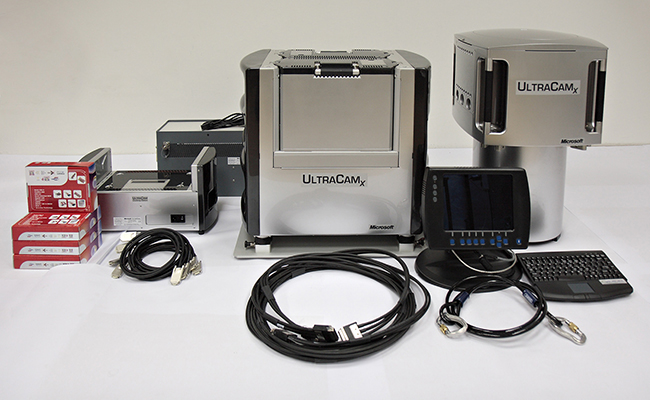
– Panchromatic Image Size : 17,310 * 11,310 pixel
– Panchromatic Physical Pixel Size : 6μm
– Angle‐of‐view, cross track (along track) : 55° (37°)
– Color (multi‐spectral capability) : 4 channels(RGB & NIR)
– Radiometric resolution in each color channel : > 12 bit
– Physical dimensions of the camera unit : 45cm x 45 cm x 60cm
– Weight : ~ 55 kg
- Frame Rate : 1 frame per 1.35 seconds
- High Resolution: Focal Length 101.7mm
- GSD (1,667m): 10cm resolution imagery acquisition
- Dynamic Range : 72db
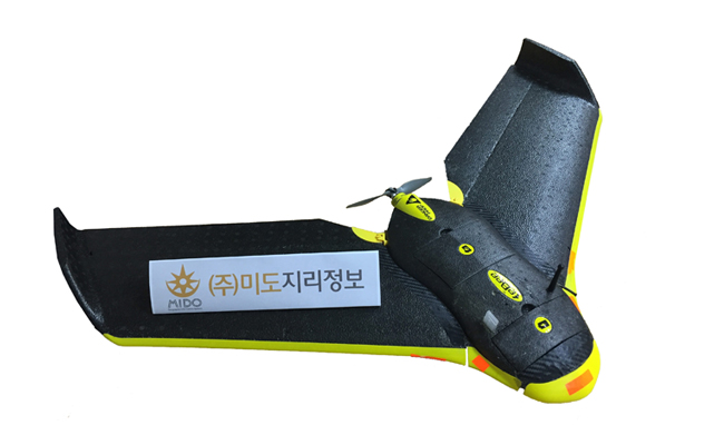
– Size : 450 * 960 * 100mm
– Weight : 0.69kg
– Maximum Speed : 90km/h
– Cruising Speed : 65km/h
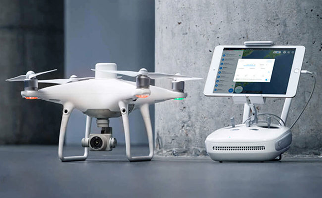
- Centimeter-Level Positioning System
- Accurate Data Collection with TimeSync
- High-Precision Imaging System
- Mission-Specific Flight Planning Apps
- Compatibility with Various Third-Party Apps
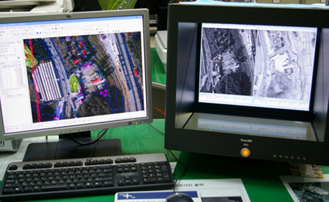
- A simplified status map management system for recording and managing extracted features interpreted from aerial photos
- Transition from traditional manual methods using magnifiers to a computerized system that enhances accuracy and efficiency
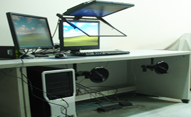
- Processing of Aerial Photos, Satellite Images, SAR, and LiDAR Data
- Production of Digital Topographic Maps
- Construction of 3D Spatial Information
- Generation of Digital Elevation Models (DEM, DSM) and True-Ortho Photos
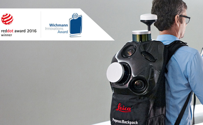
- Pegasus MDA – Field data acquisition software
- Inertial Explorer – Trajectory processing software
- Leica Pegasus: Manager – Automated mobile mapping data processing software
- AutoCAD – CloudWorx
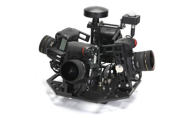
- Supports Nikon D300S, D600, D700, D800, and D5100
- Logs camera malfunctions and enables post-processing Lost Image Monitoring
- Allows configuration of minimum exposure threshold for automatic shooting
- Supports built-in GPS, tilt and heading sensors, and external INS integration
- Enables capture location and interval settings using DMI, Timer, and INS coordinates
- Provides DSLR malfunction reporting for quick response and troubleshooting
- Supports various shooting modes using DMI, GPS, INS coordinates, and internal timer
- Seamlessly integrates with GPS and GPS/INS systems
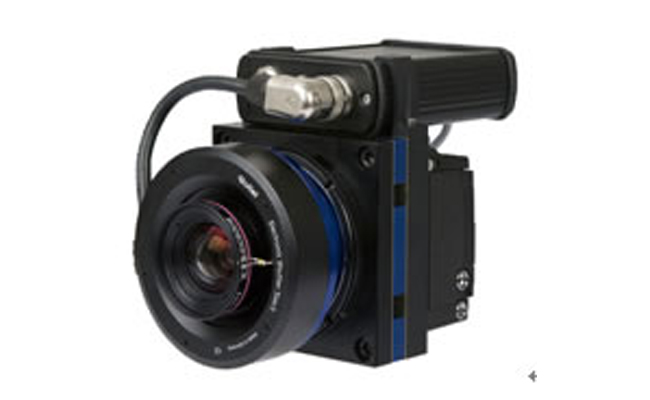
- Focal Length: 74.353 mm
- Pixel Size: 6.8 μm
- Image Resolution: 7216 × 5412 pixels
- Dimensions (cm): 11 (W) × 15 (L) × 15 (H)
- Weight: 1.5 kg
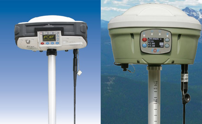
– High-Precision 3D Surveying Equipment Using GNSS Satellites
– 220 Channels
GPS : L1 C/A, L2E, L2C, L5
GLONASS : L1 C/A, L1P, L2 C/A, L2P
SBAS(WAAS/EGNOS/MSAS) : L1 C/A, L5
GALILEO : L1 CBOC, E5A. E5B, E5AltBOC
GIOVE-A : L1 BOC, E5A. E5B, E5AltBOC
GIOVE-B : L1 CBOC, E5A. E5B, E5AltBOC
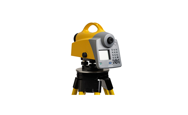
– High-Precision Leveling Equipment for Elevation Data Acquisition
– Resolution height measurement : 0.01mm
– Resolution distance measurement : 1mm
– Measurement time : 3sec
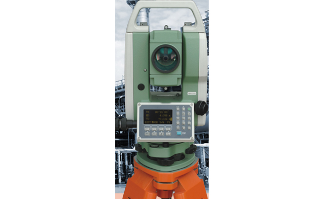
– A high-precision surveying instrument capable of simultaneously measuring angles and distances
– Measuring Range / Accuracy:
• Without target: 1–500 m / ±3 mm + 2 ppm
• With reflective sheet: 1–800 m / ±3 mm + 2 ppm
• With prism (Class 3R): 1–5,000 m / ±2 mm + 2 ppm
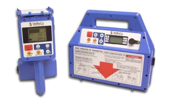
– A device used to determine the position, direction, and depth of buried underground utilities
– Fiber optic cable detection capability
– Supports multiple frequencies: 512 Hz / 9.5 kHz / 38 kHz / 80 kHz
– Maximum detection depth: up to 10 meters
|
||